One Platform.
All Responders.
All In.

LeoSight brings law enforcement, fire, and emergency management into one Unified Command platform-even across jurisdictions.

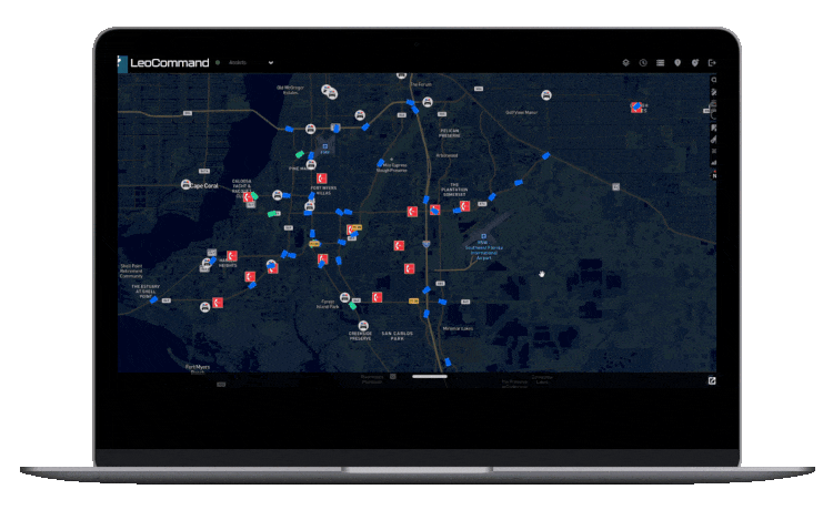
Unify
fragmented data
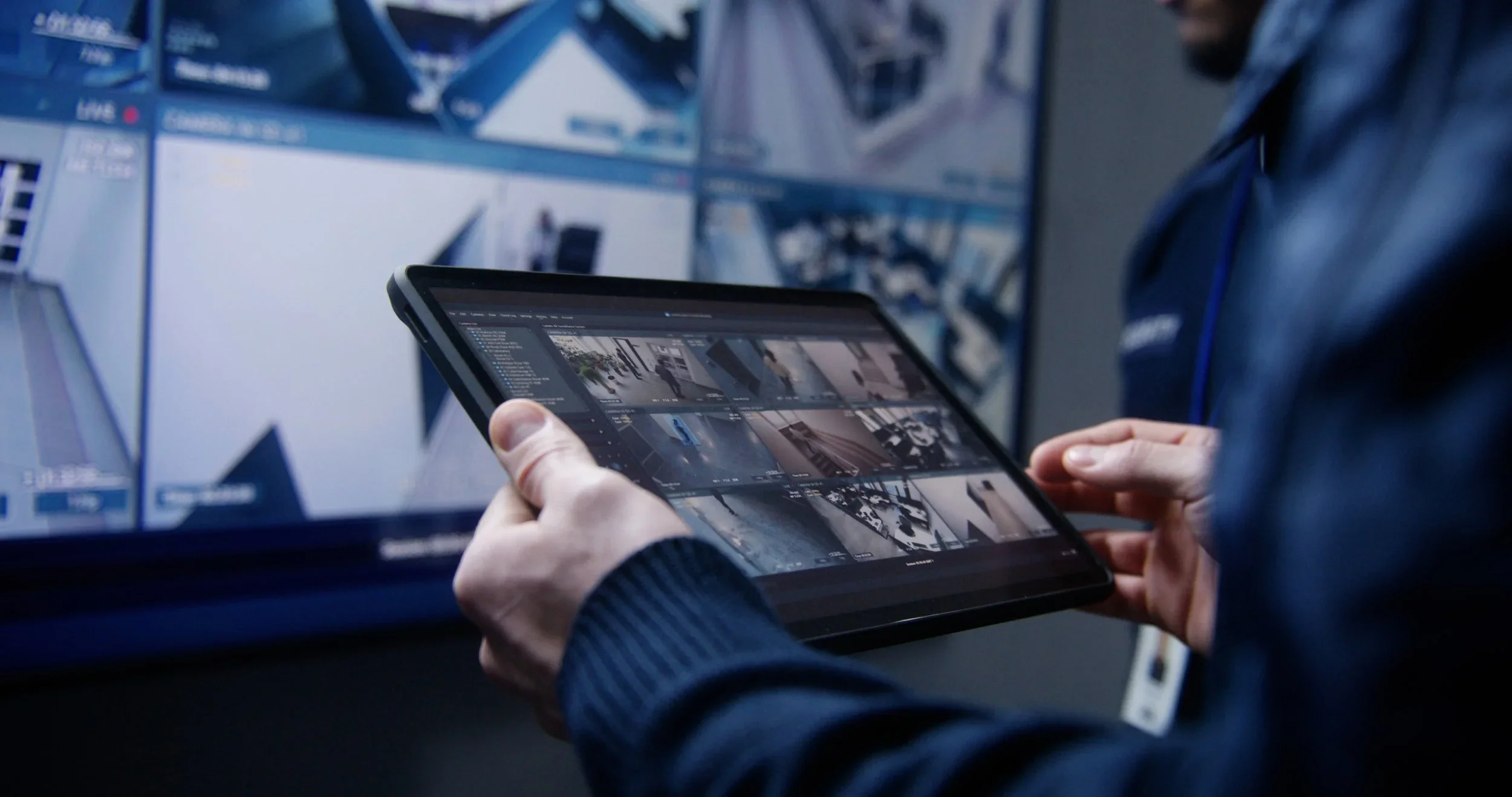
real-time Data Visualization Platform

Coordinate & Collaborate

Blurry black-and-white image of parked cars on a city street at night with streetlights overhead.
Black and white photo of a female police officer and a male firefighter seated with a police dog between them, facing away from the camera.
Pixelated beige squares and rectangles scattered on a white background

Most platforms stop at law enforcement.

We start with the entire mission. LeoSight brings public safety teams together—no matter their badge, patch, or discipline.

Data is fragmented

forcing teams to make decisions without a full operational picture

Icon of three documents with binary code (0s and 1s) on the front page, a warning triangle with an exclamation mark, all on a dark teal background.

Real-time collaboration is limited

especially across commands, field units, and outside partners

Outline of a stopwatch with a green background

Investigative support is reactive

with no streamlined way to manage or fulfill time-sensitive requests

Warning alert on computer screen with exclamation mark inside triangle

Agency leaders lack situational clarity

making it harder to direct resources and measure outcomes in the moment

Icon of two circular arrows surrounding a dollar sign, representing money exchange or financial transactions.
Aerial view of a neighborhood overlaid with a digital, futuristic radar or targeting display
Laptop screen displaying a digital map with various icons and traffic information.

Built for real-time coordination across agencies, disciplines, and jurisdictions—LeoSight gives every responder the tools to lead with clarity. 

Black and white QR code

With LeoSight, Agencies Can

A digital dashboard displaying a city map with infrastructure data, graphs, and analytics in a high-tech interface.
Icon of a computer monitor displaying a map with a location pin.

Monitor unfolding incidents

with a live, map-based view of units, activity, and alert

Blank white background with no objects or features.
Close-up of person typing on a laptop keyboard at a wooden desk, with smartphone nearby.
Icon of three 3D blocks, a compass with the letter N indicating north, on a brown background.
A blank white square image.

Tailor views and permissions

to fit real-world roles and workflows

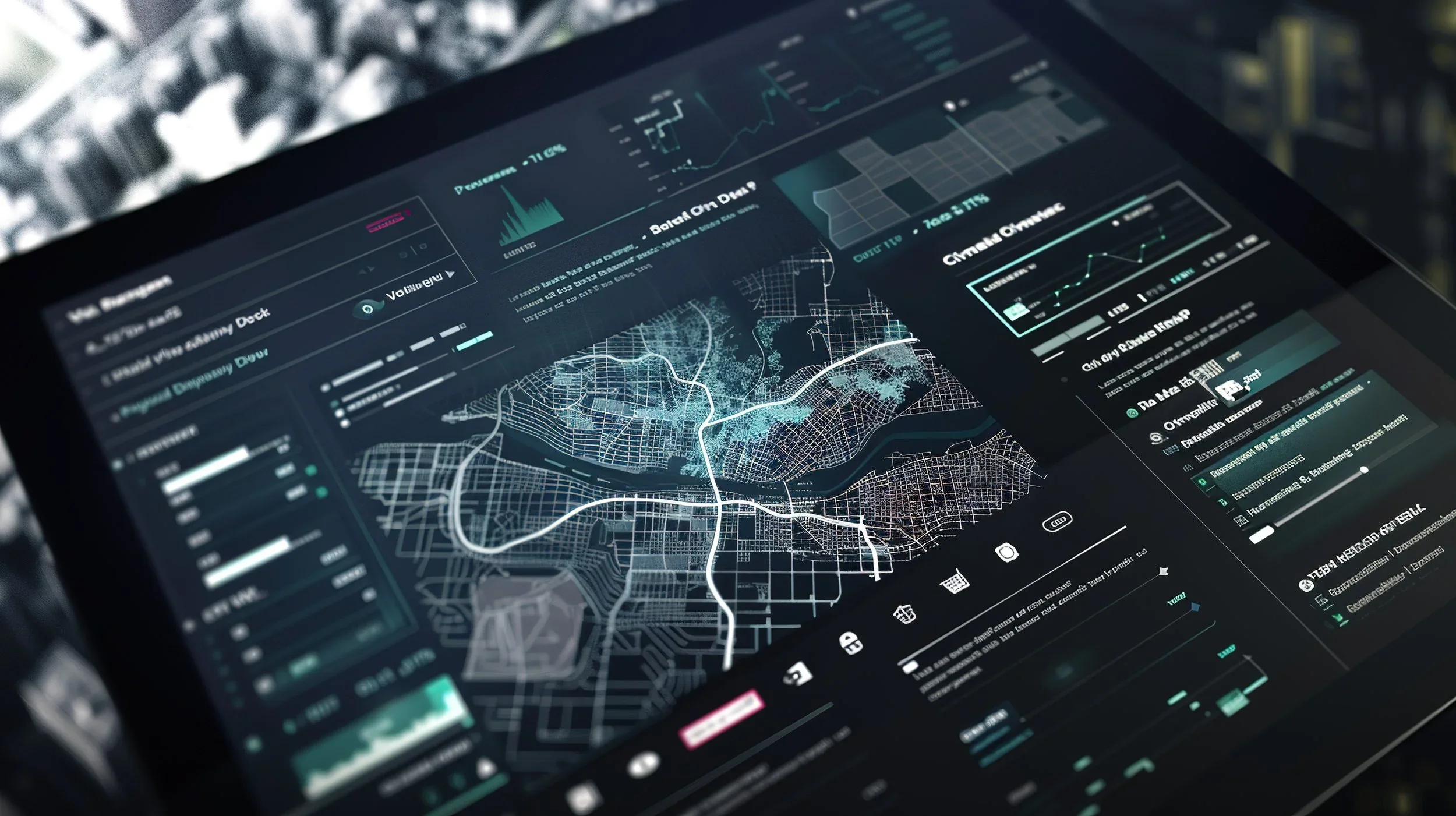
Coordinate across teams and jurisdictions

from a single shared operating picture - accessible in your Real Time Crime Center, laptop, MDT, tablet and phone

Person holding a tablet with security camera footage displayed, in a store or security monitoring room.
Flowchart diagram with points labeled A and B connected by a curved line.
A blank white sheet of paper.

Built for Now. Ready for What’s Next.

Other platforms connect cameras. We connect agencies - for unified command that actually works. 

LeoSight empowers unified response and real-time coordination—bringing law enforcement, fire, EMS, and emergency management together into one live operational system. 

Black police patrol car driving on an open highway in black and white.
Black cube shapes and dots arranged in a diagonal pattern.
A white police drone flying over a cityscape in black and white.

LeoSight is Built to Scale

Whether you're building a command center or just getting started, LeoSight scales to your agency’s needs—across law enforcement, fire, EMS, and emergency services.

From regional collaboration to single-agency deployments, we tailor each plan to your mission, size, and budget.

Black and white QR code.

How LeoSight Works

01. Learn Your Needs

We begin by understanding your systems, goals, team structure, and external agency collaborators.

02. Configure Your Solutions

LeoSight is tailored to your environment—integrating CAD, AVL, LPR, RMS, VMS, and DFR capabilities for real-time operational impact.

03. Launch and Train

We deploy quickly and train your team to ensure every role—from command to field—is ready on day one.

04. Support and Evolve

Our partnership doesn’t stop at go-live. We provide ongoing support and continuously deliver new capabilities that drive your mission forward.

Diagram showing data layers for a map, including terrain, street, satellite, and nautical charts, with icons representing layers, search, cloud, analytics, and lock symbols surrounding a city map in the center.

We empower agencies with the speed and insight they need to protect their communities...every day.

Pixelated abstract pattern in shades of brown and beige.