
LeoCommand
A shared, real-time view of incidents, units, and data across your agency or region
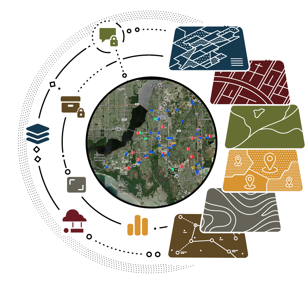
Supports response coordination through real-time integration of CAD, AVL, DFR, ALPR, video, and sensor feeds
Enables situational playback through a timeline interface to review unit movement, video, and event triggers
Enhances oversight across agencies with shared visibility and regional coordination tools

LeoCommand Key Features
-
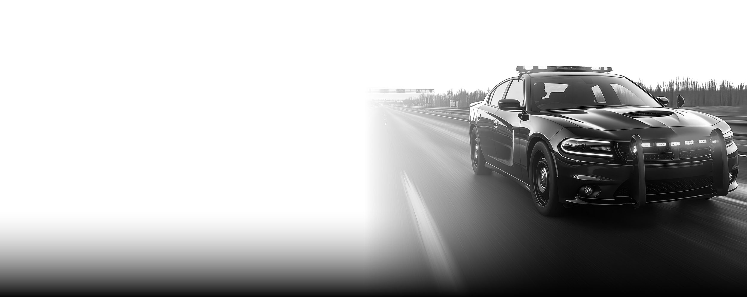
Detachable CAD Drawer
Pop-out, multi-monitor CAD panel fully synced with the map
-
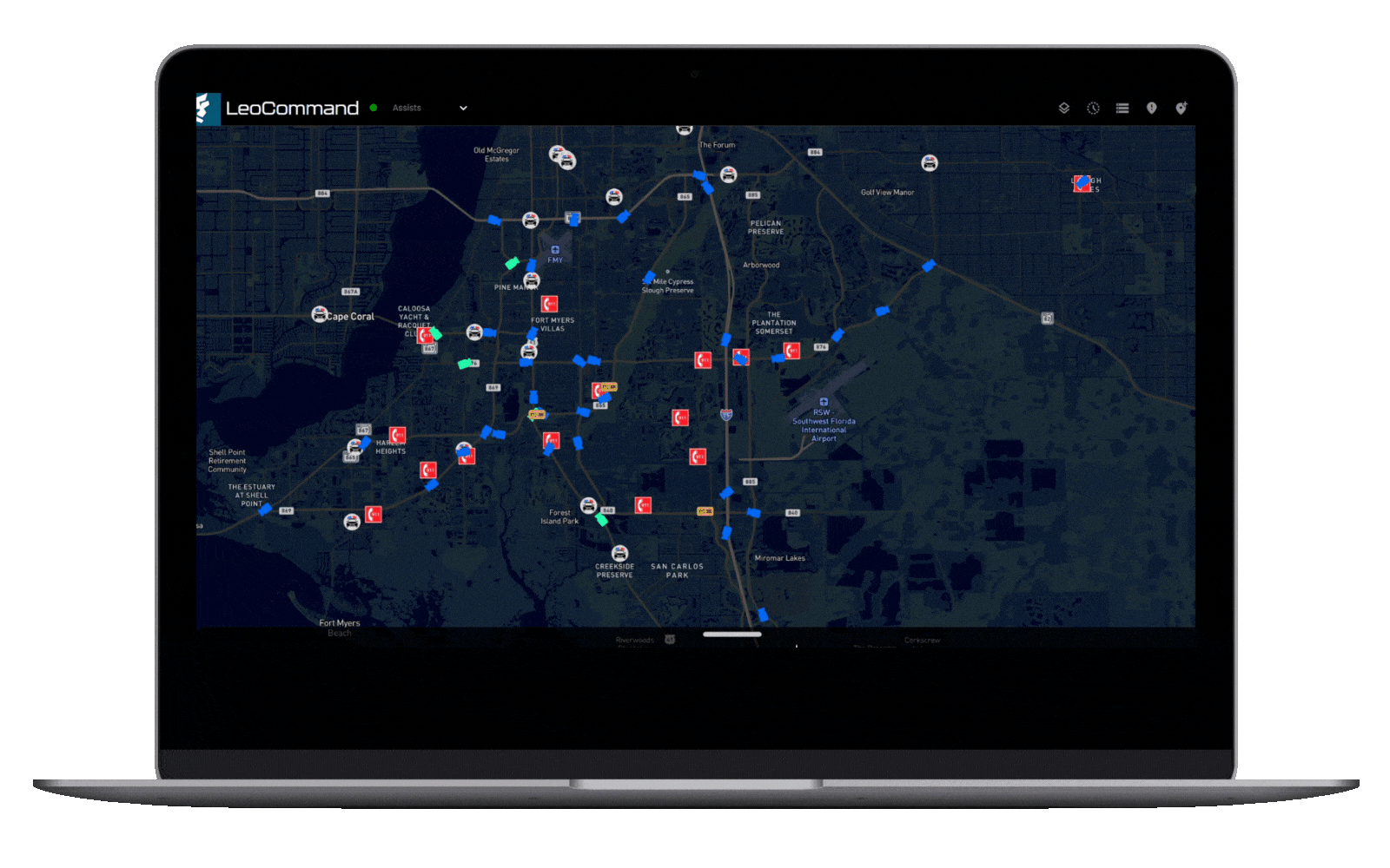
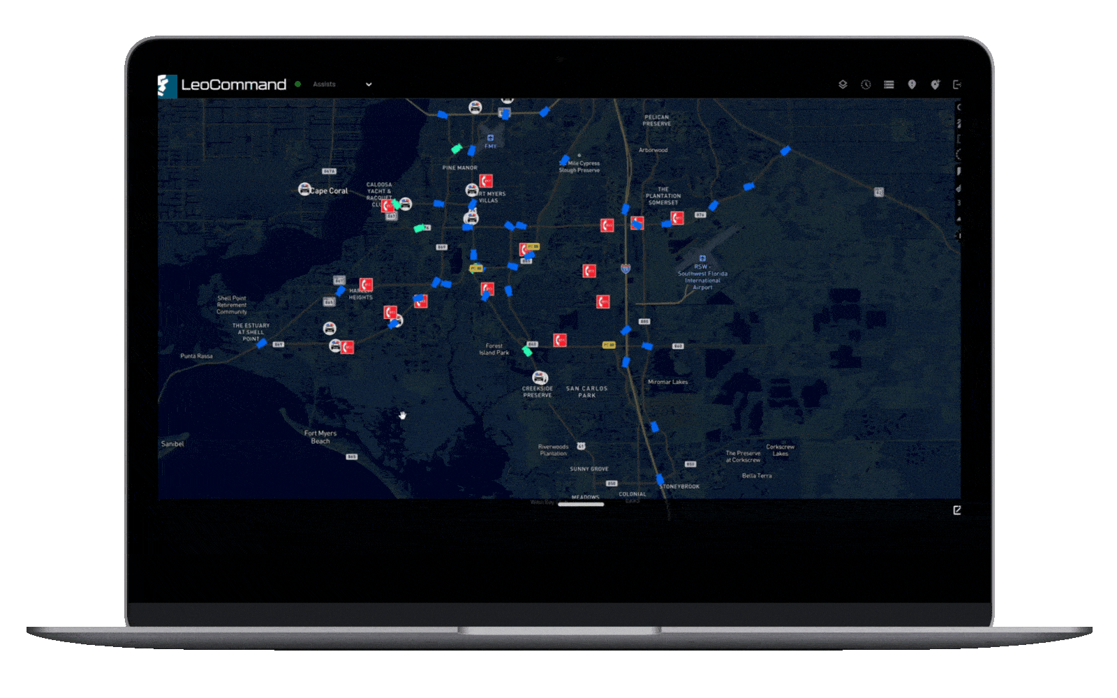
Live Operational Map
View units, calls for service, DFR (drone) activity, ALPR hits, and gunshot detection in real time
-
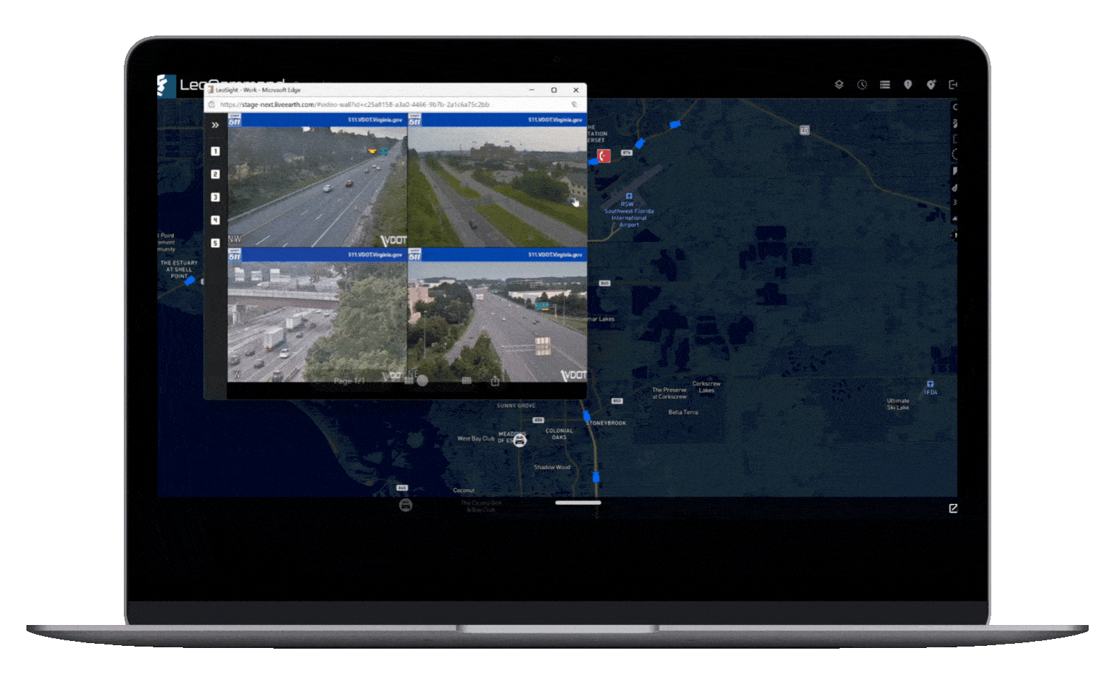
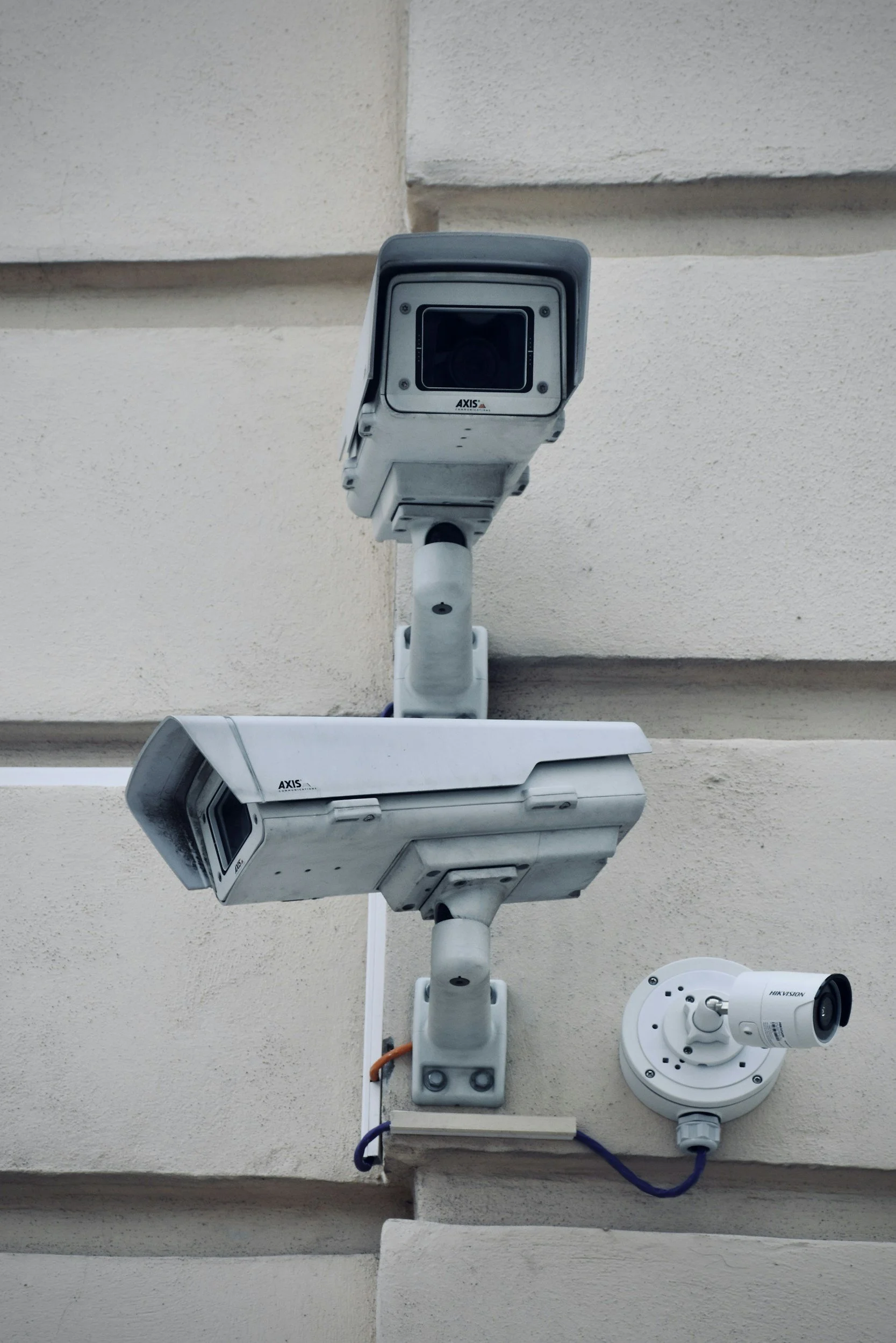
Integrated Alerting + Live Camera Access
Instantly act on alerts by accessing nearby live cameras in real time
-
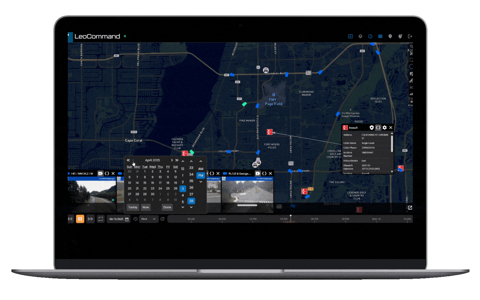
Global Timeline Playback
Replay synchronized video, sensor events, unit tracking, and drone response footage
-

Customizable Incident Views
Leverage a flexible toolbox to tailor visualizations and filters to your agency’s workflow


Real-Time Operations Center Visibility. No Walls Required.
LeoSight brings RTOC-level visibility to your entire team—whether they're in a command center, on an MDT, or using a mobile device. Designed for real-time coordination and incident response, LeoCommand delivers what matters most, exactly when and where it's needed.
Who It's Built For:
Law enforcement agencies of any size, with or without a physical RTCC/RTIC/RTOC
Fire, rescue, and EMS teams managing incident response
Field supervisors, command staff, and operational leads
Investigators and analysts accessing video, data, and timelines
Multi-agency task forces and regional coordination groups

Command and Control is just the beginning.
LeoSight is a modular suite of solutions designed to grow with your agency—ready to support broader coordination, deeper collaboration, and new capabilities as your mission evolves.
Frequently Asked Questions

-
LeoSight is a real-time operational environment for public safety that integrates systems like CAD, AVL, ALPR, sensor and video feeds, and provides a live map & timeline interface. It’s used by law enforcement, fire, EMS teams, field supervisors, and regional coordination groups to improve situational awareness, mission control, and response coordination.
-
LeoSight supports shared visibility by connecting different data sources across agencies (CAD, RMS, video, etc.), letting stakeholders see the same live map, incident feeds, alerts, and timelines. Permissions/views are tailored to roles so each user only sees what’s relevant, but everyone shares a unified situational picture.
-
Yes. LeoSight includes a Global Timeline Playback feature that enables users to review unit movement, video feeds, sensor triggers, and event interactions after the fact. This helps with post-incident reviews, training, and improving future response plans.
-
The platform supports integration with key public safety systems—CAD (Computer-Aided Dispatch), AVL (Automatic Vehicle Location), ALPR (Automatic License Plate Recognition), video/sensor feeds, and more. Deployment includes configuration for agency-specific workflows, role-based permissions, and training so teams can get up and running fast. Ongoing support continues after launch.